AAWT Day 20 – Cleve Cole Hut to Mountain Creek Car Park

I am writing this 2 days after returning to the city and I still feel weird and removed from this life, but this feeling is lessening every day.

15781756_10154837582354859_4812554986172865202_n.jpg

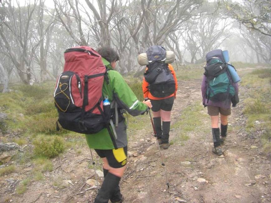
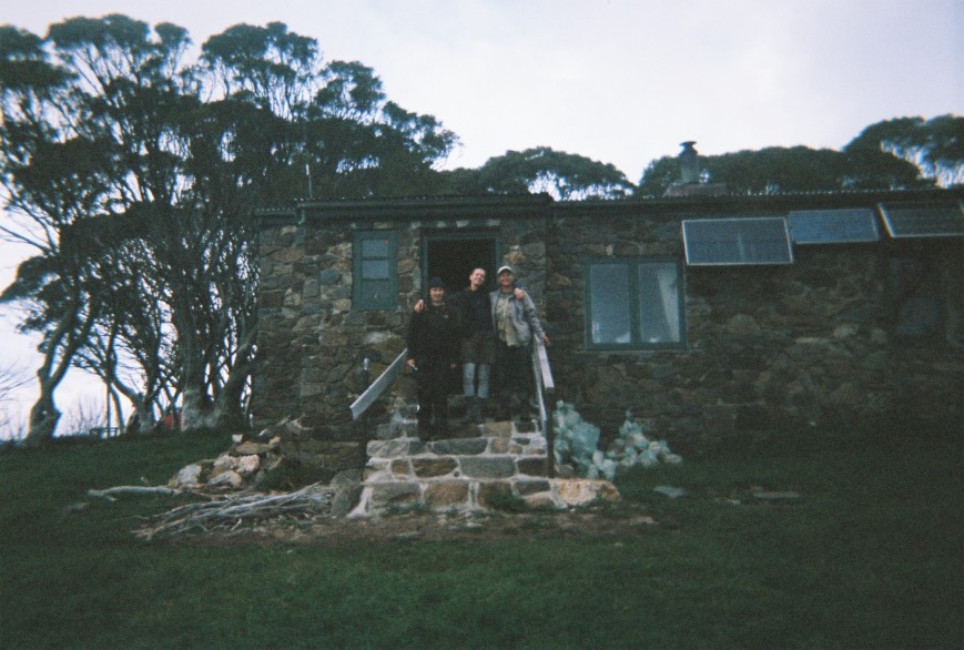
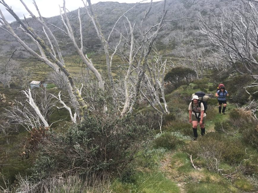
Gang at Cleve Cole, Photo friendly hiker

15741254_10154837576609859_7374209265386755080_n.jpg

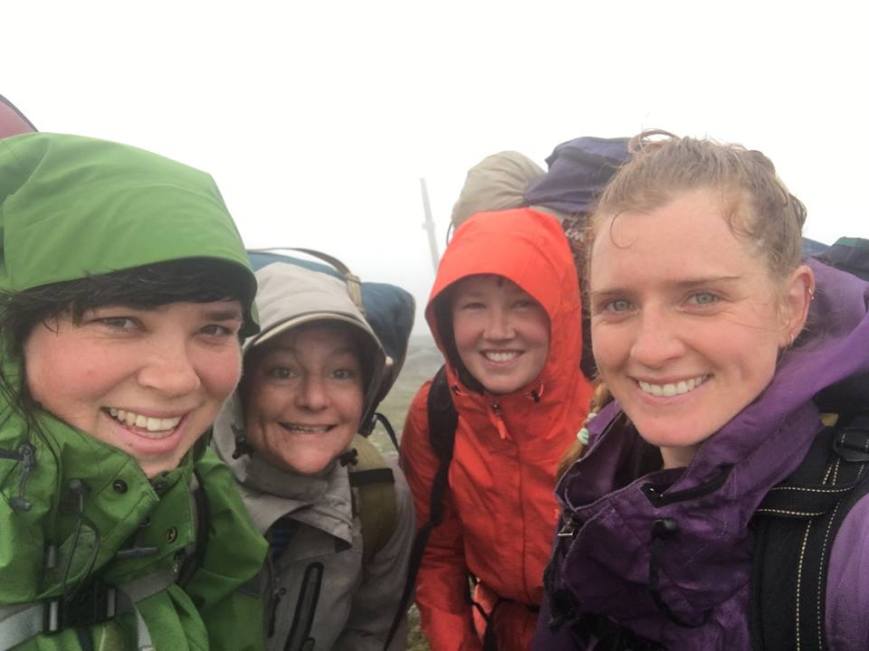
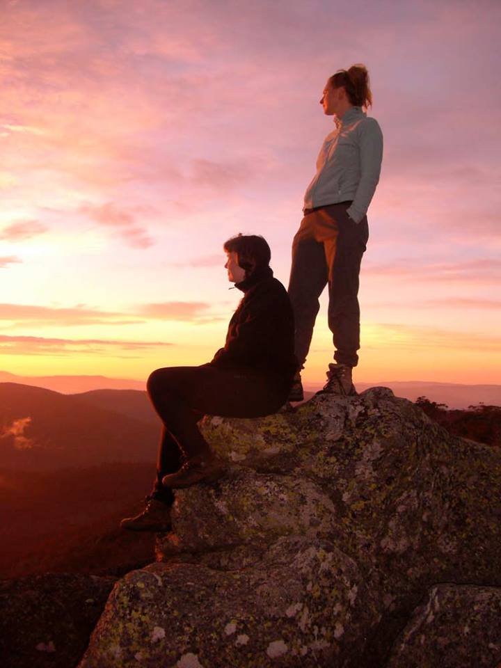
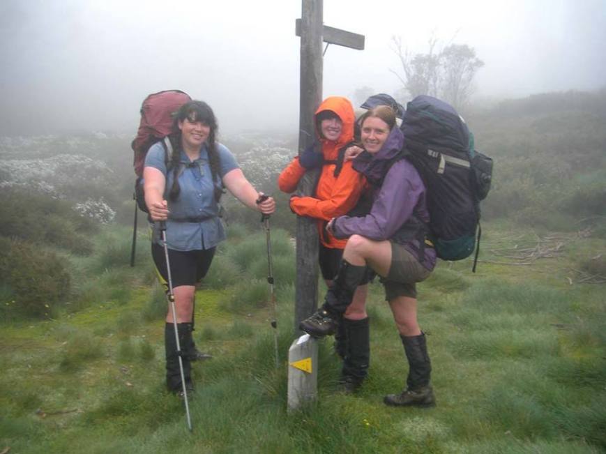
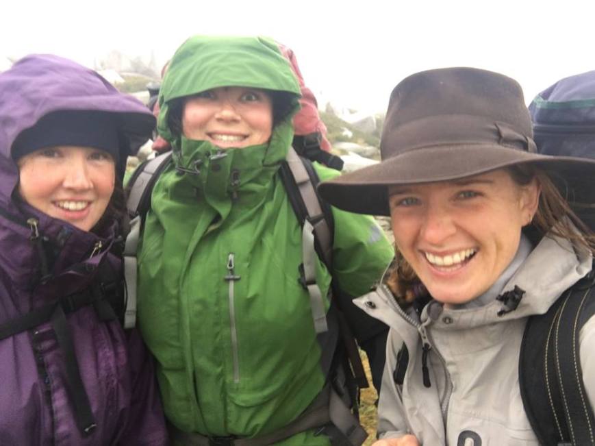
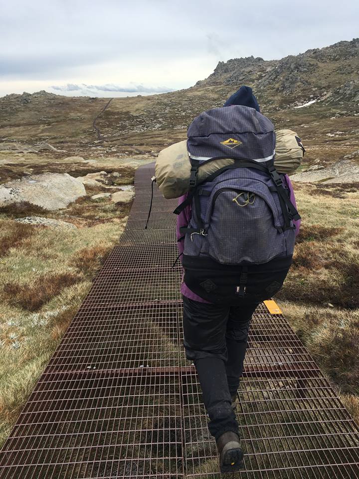
Gang chilling on the summit, Photo Meg Wettenhall

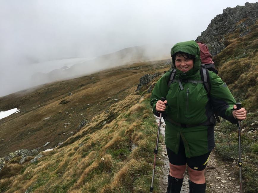
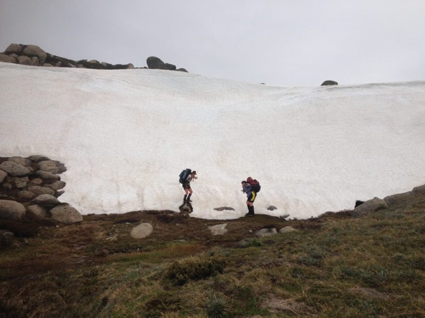
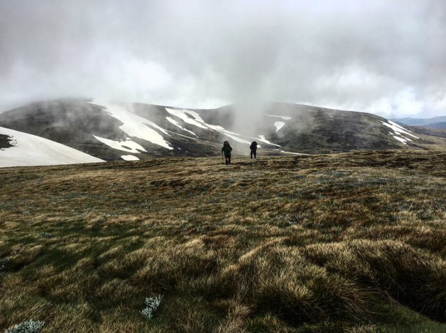
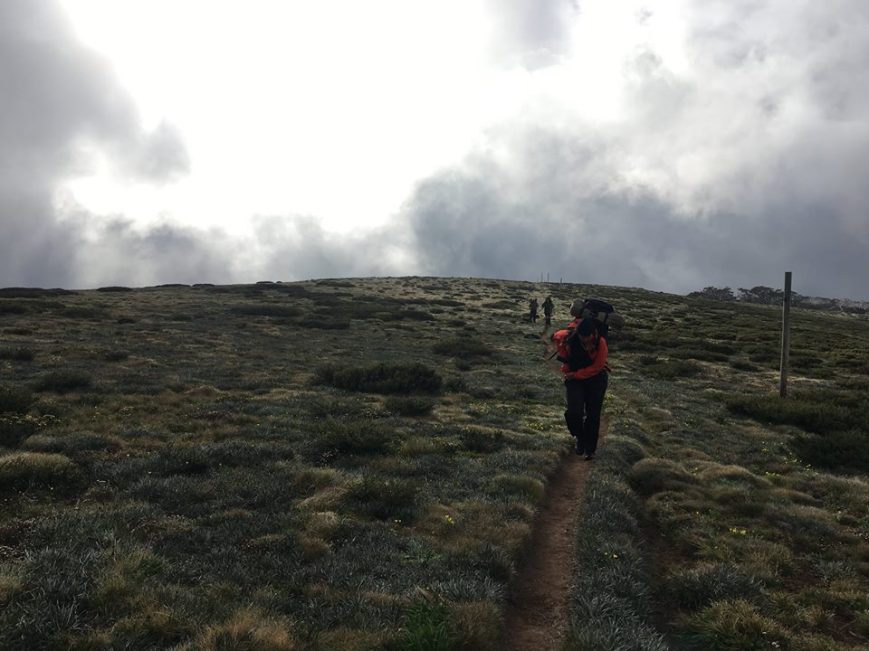
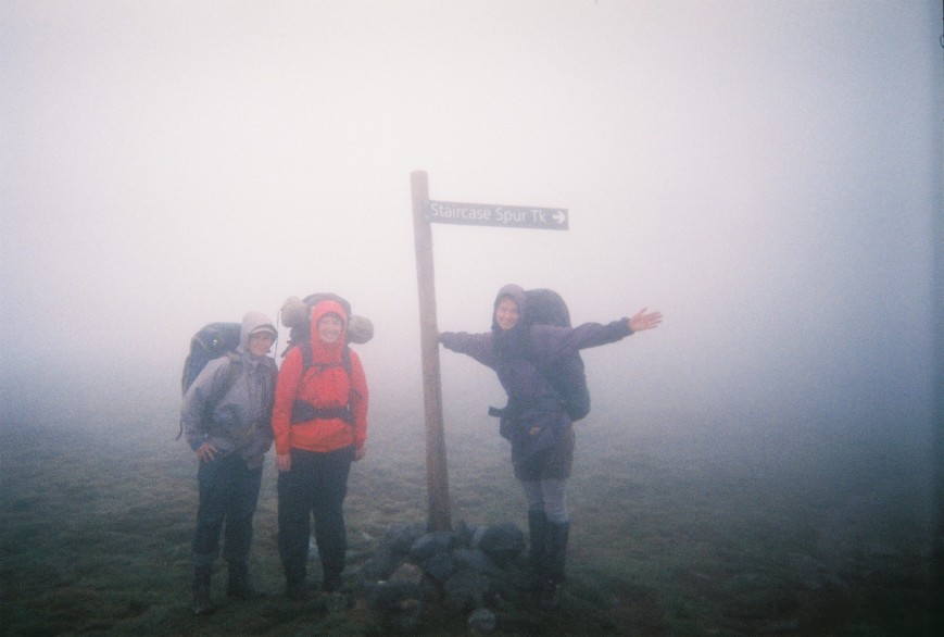
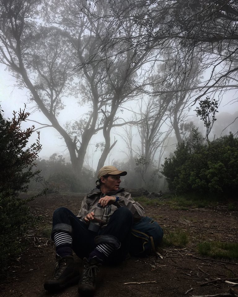
With the promise of a pub lunch we were all pretty eager to get going, yet the whole 1500m descent was still bittersweet as we watched the foliage change from alpine to planes one last time. My hopes of the cloud clearing overnight did not come true and we walked up the final 200m climb to the summit of Mt Bogong in wild winds and swirling mist that wasn’t quite rain but managed to sneak under our collars and into our raincoats. Reminding us of our time on the Main Range but not as extreme, we were all pretty relaxed and took selfies in the terrible weather. I was secretly disappointed as the last two times I was on Bogong I was in similar weather. We passed Hells Gap and were reasonably well protected but as we approached the Staircase Spur turnoff the wind practically pushed us off the mountain.

15697207_10154837580899859_8317859691748220228_n.jpg

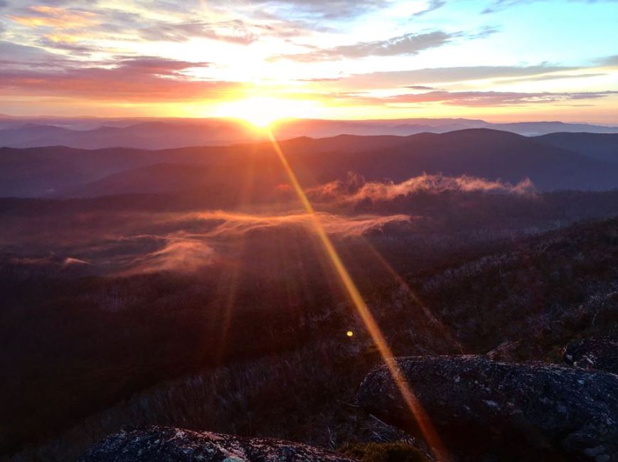
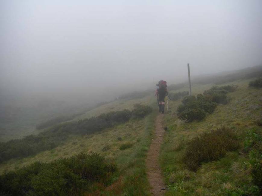
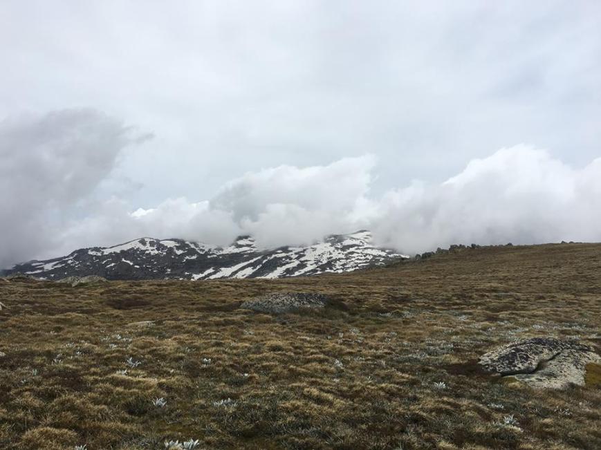
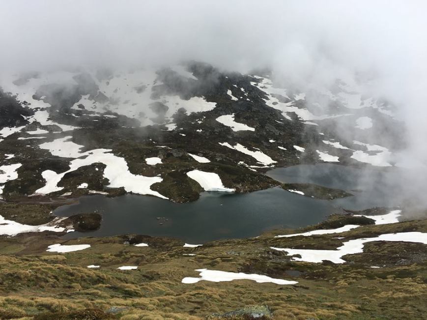
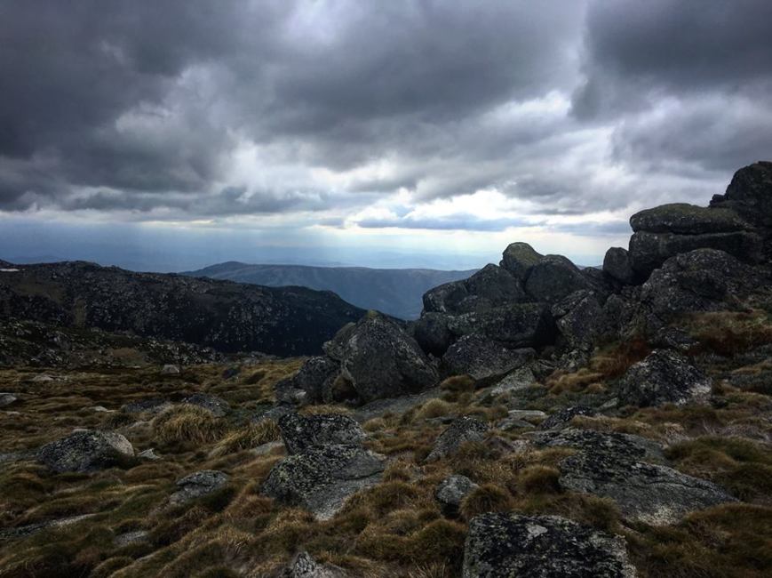
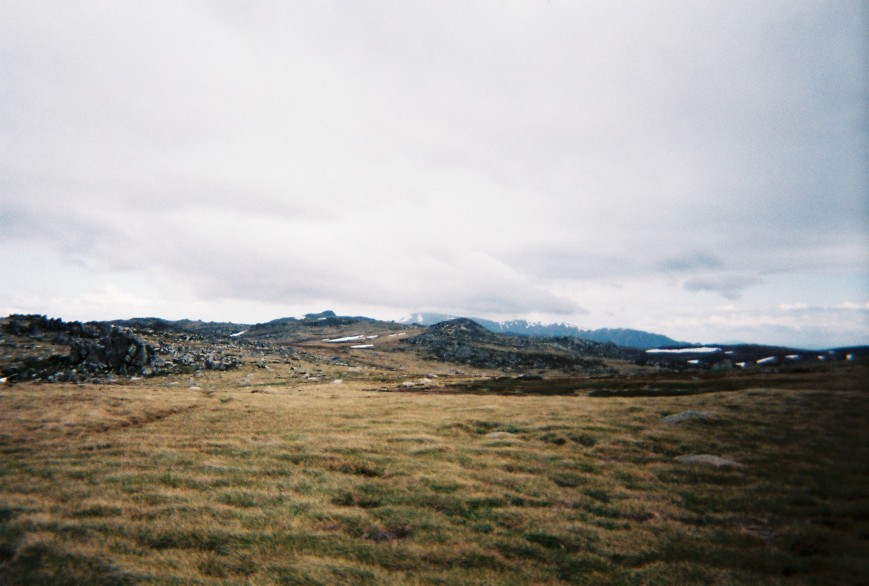
Cloud threatens, Photo Meg Wettenhall

15541576_10154837581294859_329523766507142695_n.jpg

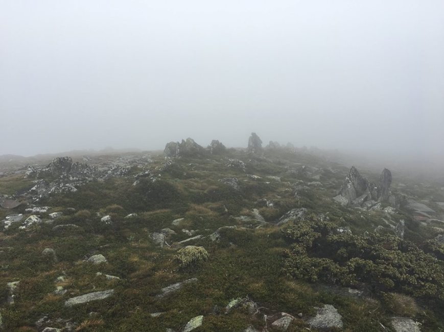
Cloud arrives, Photo Meg Wettenhall

000030.JPG

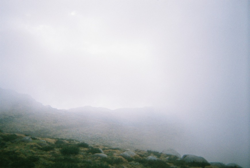
Cloud wins, Photo Phoebe Robertson

The Staircase track was beautifully made with many stone steps and a gentle gradient for such a long descent. I said goodbye to my favourite stunted snow gums and green grey snow grass and arrived at Bivowack Hut for a quick knee break/time-out. This is my first hike with poles as I previously thought they were only for oldies, but I am now a total convert and love them. I have had very little knee pain this whole trip and I have had a knee reconstruction.

15776764_10154837582614859_4727345285472405889_o.jpg

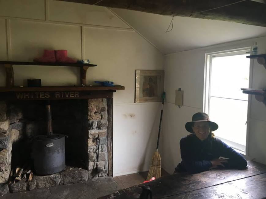
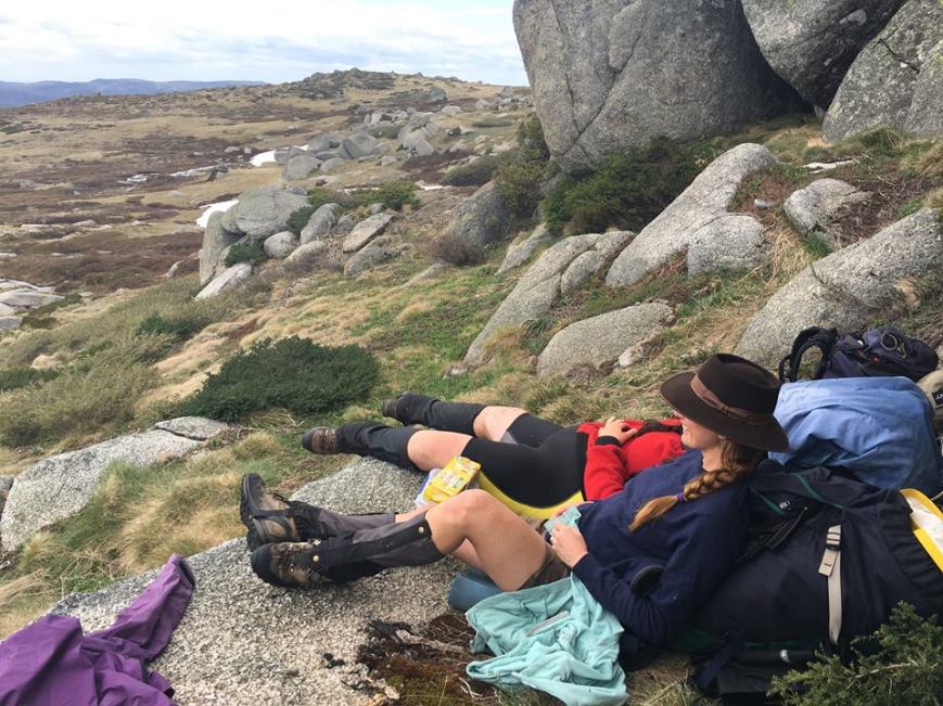
Knee break, Photo Meg Wettenhall

The Hut heralded lower elevation forest and the trees suddenly became huge and the mist broke up and we saw the sun! We passed many people climbing up and shocked many of them with our weather reports from the summit as apparently it has been excellent weather in the low lands. Some day-hikers weren’t even carrying jumpers! I don’t think they will make it far past Bivowack Hut. The ground was littered with many skeleton leaves and Mia and Meg saw a satin Bower Bird.

Down in the valley we crossed Mountain Creek numerous times on our final jeep track walk to the car park. We saw 3 snakes in 3kms (one a 15cm long bb tiger snake) and decided we had entered snake pit #2! Da da dahhhhhhhh! Bye.

000031.jpg

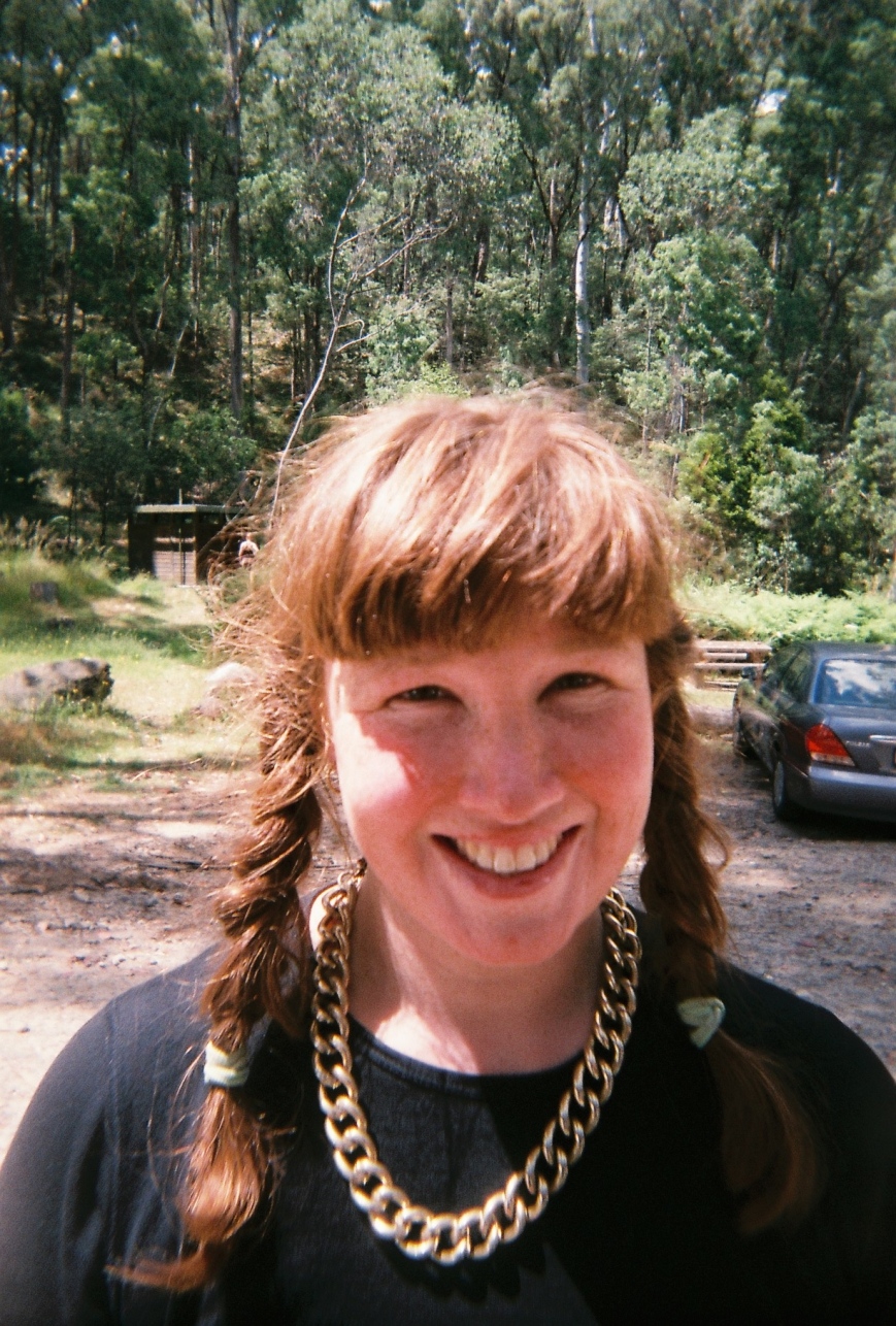
Harriet 3 weeks out, Photo Phoebe Robertson

000032.jpg

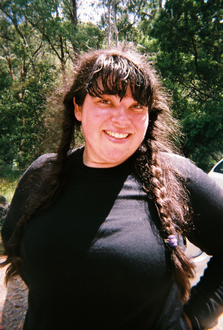
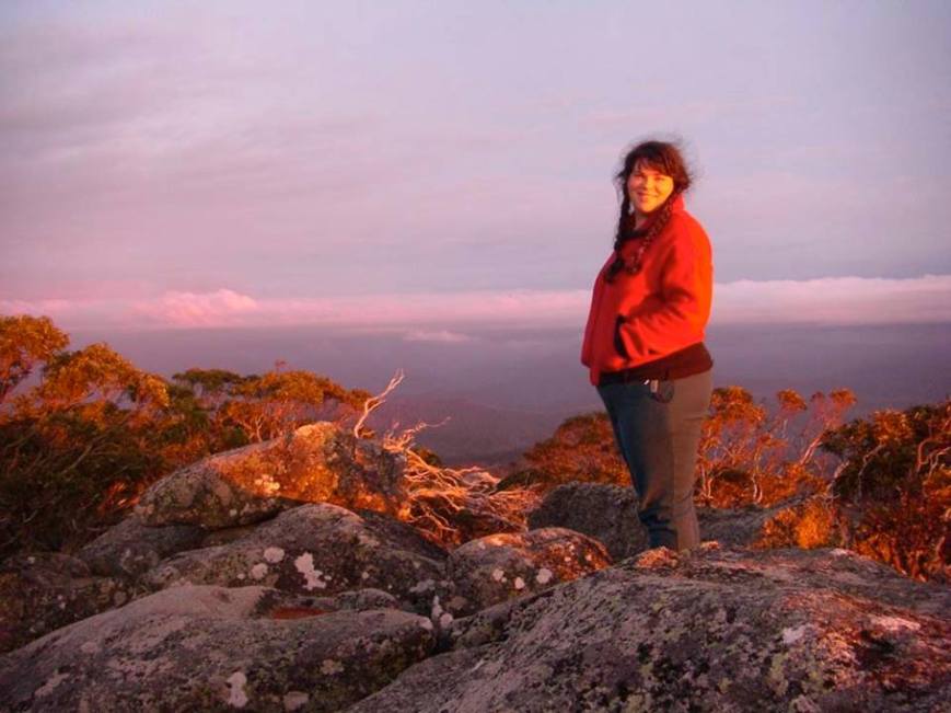
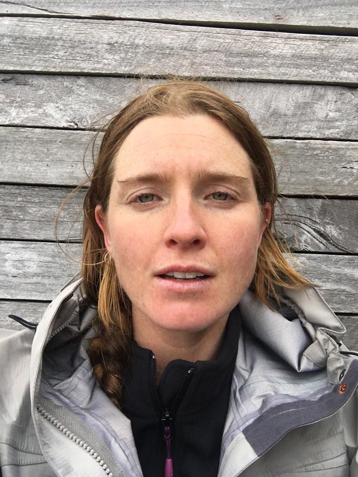
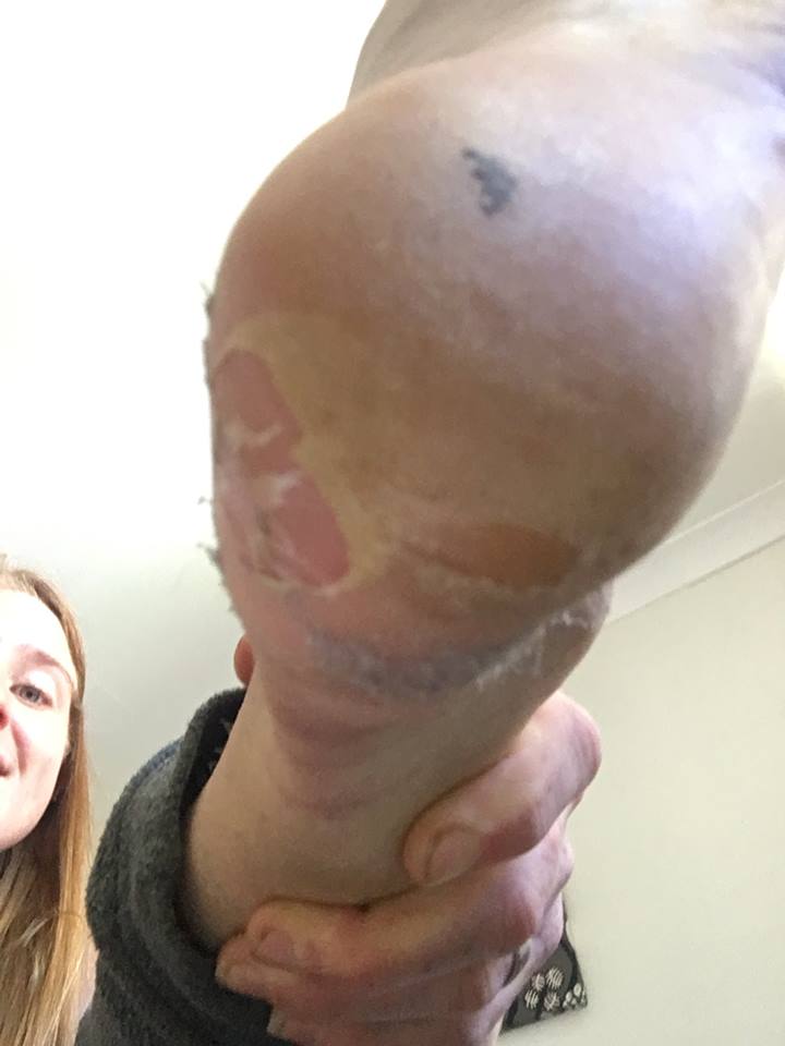
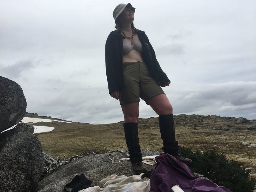
Me (Phoebe) 3 weeks out, Photo Mia Schoen

000033.jpg

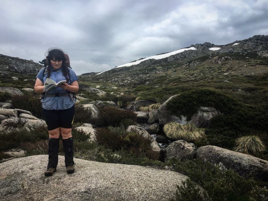
Mia 10 days out, Photo Phoebe Robertson

000034.jpg

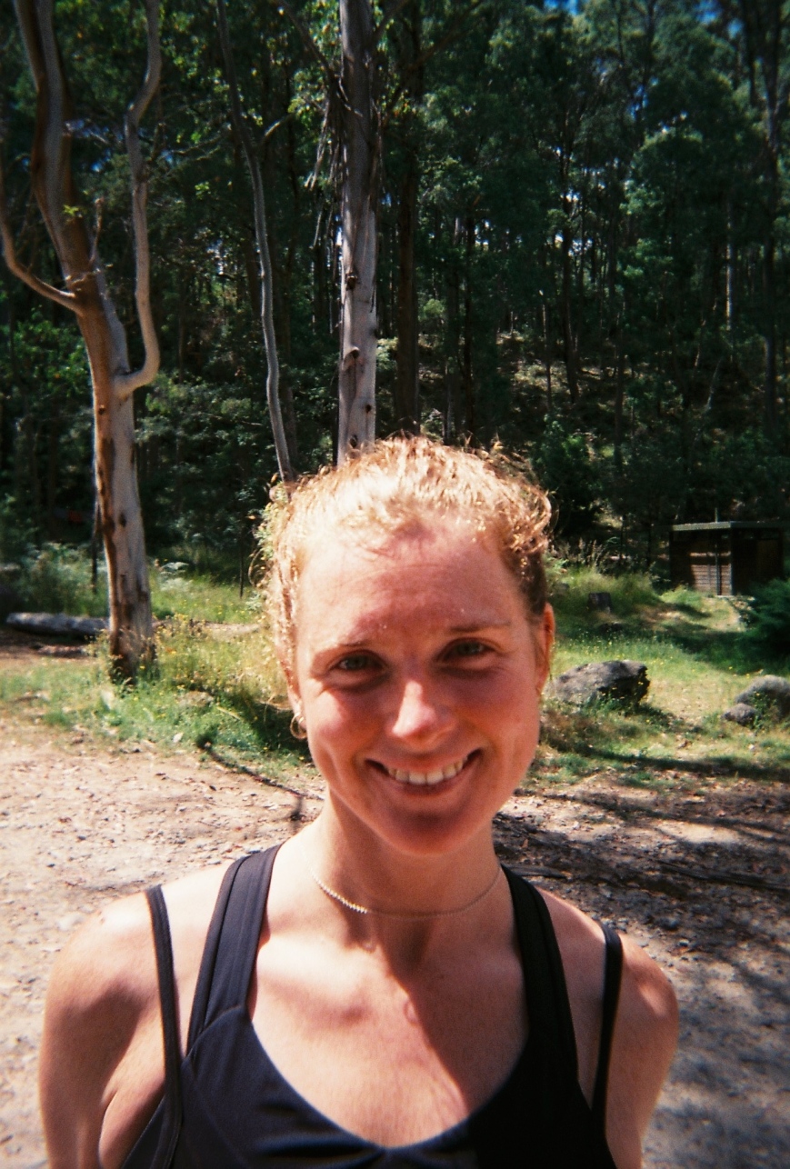
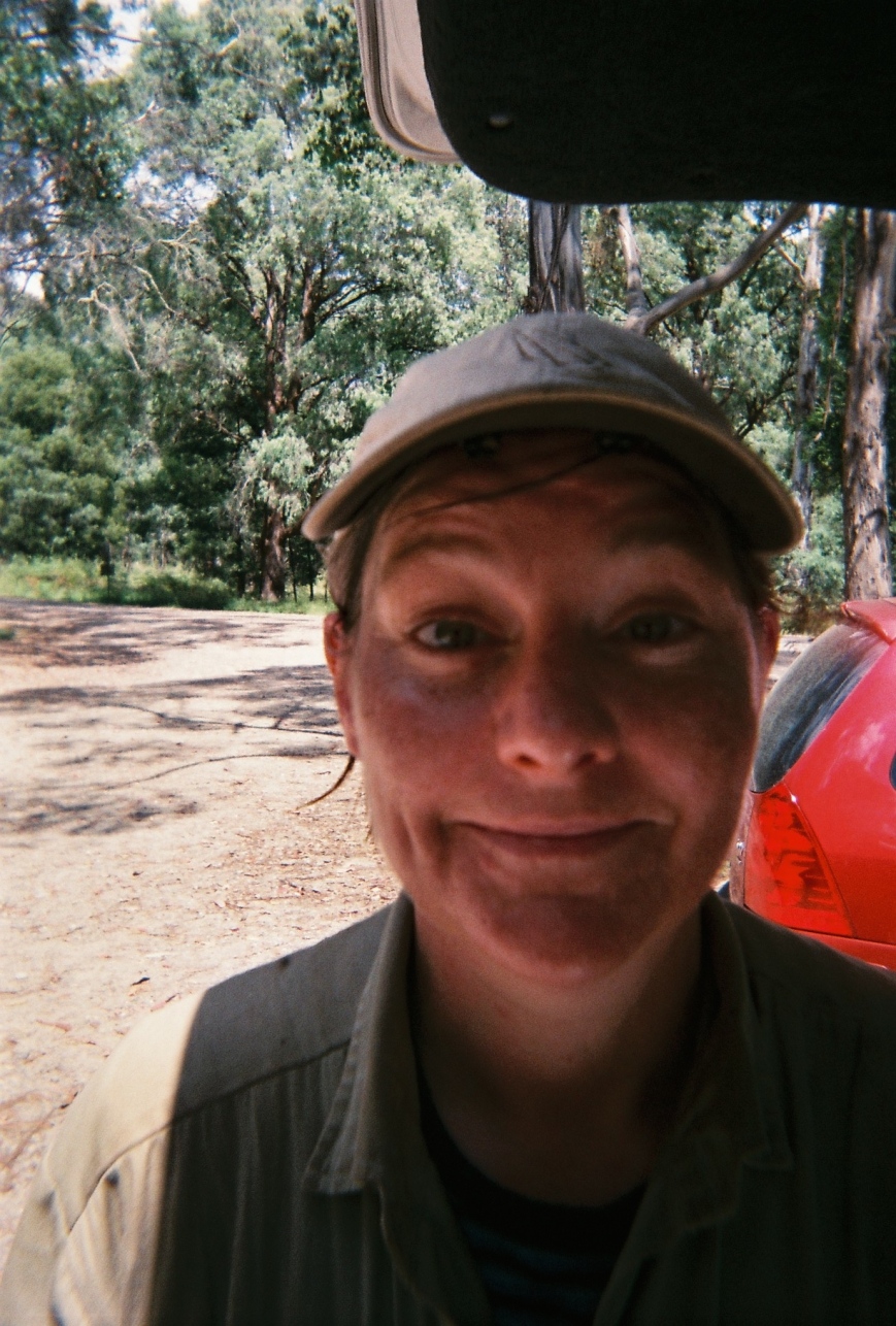
Meg 3 weeks out, Photo Phoebe Robertson

AAWT Day 19 – Mt Wills to Cleve Cole Hut

Oh no! Its our last full day on the track. I reckon this walk has been a success, and I have had a real adventure with my best friends and family. At the same time I am also looking forward to some of the instant and easy comforts of home; hot shower, eating things that you don’t boil, not being able to smell myself and chairs!

It’s Harry’s Bday today! We all woke at 5am to watch the sun rise from the magic Mt Wills rocks. We raucously sang Happy Birthday as the sun peeped over the horizon, and we watched the mountains to infinity change colour and light the Main Range pink and gray. Tendrils of cloud moved in from the west/Mt Bogong like fingers grasping for us. Getting cold we lit a fire at camp and made our last bit of cowboy coffee. I didn’t notice the clouds roll in while packing up the tent but when I looked up Mt Wills was shrouded in fog. It became colder and we all set out gaitered and coated up.

15665659_10154940267062642_2530420159574647929_n.jpg

Beauties, Photo Phoebe Robertson

15578464_10154940267672642_1513448987696334703_n.jpg

Sun’s coming up, Photo Mia Schoen

15673067_10154837579219859_2320157877412246120_n.jpg

Happy Birthday Harry! Photo Meg Wettenhall


We meandered down the jeep track leading to Omeo Highway through the same brilliant snow gum forest as yesterday, only this time eerie in the mist. Taking a left turn we descended on a foot track down another steep and direct path out of the snow gums to Big River Saddle, loosing 600m quick! From the little clearing and intersection of jeep tracks we started our 900m climb up Long Spur to Cleve Cole Hut.

15697183_10154940268452642_724466276936166166_n.jpg

Eerie snow gums, Photo Mia Schoen

15622252_10154940267817642_7863800047521064718_n.jpg

Double-checking the bible, Photo Mia Schoen

15622268_10154940270102642_6793679993076708428_n.jpg

Scrubby trail, Photo Mia Schoen


The first few kms went by quickly on well graded open dirt road, visibility had improved in the lower elevations, but cloud was still thick in the air. The jeep track quality quickly disintegrated and by the time we reached the crest of Long Spur we were breast stroking through thick vegetation over our heads. The mist was wet, the intermittent rain was wet, the foliage was wet, we got very wet, water managed to get inside raincoats and rain pants. We then entered a white out time warp with 5m visibility. On our undulating track which neither climbed or descended quickly we had absolutely no reference points to figure out how far we had gone. It felt like we were walking in a loop, on and on, never starting that final climb that would lead us to Mt Bogong proper. Meg was getting tunnel vision and asked for a pep talk as we too a break before our final climb (unbeknown to us in the mist). This is quite a feat, after 19 days of walking Meg struggles for the first time, Mia Harry and I have voiced, cried and got angry at the trail numerous times, Meg just once. Powerful lady!

15622566_10154940266767642_4844810497716065832_n.jpg

Oh the views :(, Photo Mia Schoen

15697480_10154940267087642_332393847477729486_n.jpg

Bye bye AAWT, ❤ forever, Photo Mia Schoen

We were all so cold and relieved by the time we reached Maddison Hut Site, till we realised that this was the point when we had to leave the AAWT, our trusted guide, who got us over Mt Kosciuszko in a storm, who led us over only 3 paved roads in 3 weeks, who showed us brumbies and native wildlife in abundance, and who was always there for us. AAWT we love you!

000029.JPG

The gang at Cleve Cole Hut, Photo Phoebe Robertson


Despite our AAWT love we were all very excited to get to Cleve Cole Hut where we promptly made Harry her B’day blueberry pancakes and freeze-dried strawberry ice-cream, which was more of a mousse. Cleve Cole Hut is busy with 3 large families camped here. We had planned to hang out in the hut more but after 3 weeks of hardly seeing anyone we were a bit challenged by 15 people in a small space. The cloud had mostly lifted by late afternoon and so we pitched the tent and hung around outside, watching the surrounding mountains dip in and out of cloud. The sun even made a very brief appearance after dinner. Hopefully this signals a better day for tomorrow so as we are not swindled of views when we climb to Bogong’s summit.

000027.JPG

Stinking up the hut, Photo Phoebe Robertson

15726204_10154837579944859_455237166919070932_n.jpg

Birthday cutie! Photo Meg Wettenhall

000028.JPG

Hint of sun, Photo Phoebe Robertson

AAWT Day 10 Anton-Anderson Saddle to Thredbo Village

It seems surreal writing this from the comfort of a hotel bed when this has been one of the most extreme bushwalking days of my life! We woke up to no rain but howling winds and clouds moving so quickly through the pass I could never keep up with them. The never ending cloud bubble hugging the Main Range is what we walked through today, where do they keep coming from!?

15747339_10154837521464859_5206799600352261864_n.jpg

Somewhere on the Main Range, Photo Meg Wettenhall


We all had cabin fever after spending 14 hours in the tent and so we decided to walk over the top of the Main Range even though the Bible warned us not to. Our plan was to follow the faint pad/cairns we had followed the day before, if we lost the track we would pitch the tent and wait out the weather or retrace our steps. Dressed in most of our clothes we did a speedy pack-up and set out in a tight group to face the Main Range in appalling conditions.

15697177_10154837510324859_566349491036207913_n.jpg

Crazy fools! Photo Meg Wettenhall

000031.JPG

Great views, Photo Phoebe Robertson

It was so cold my legs felt weak and we had to climb 500m in elevation over 4 mountains before he hit our first landmark, a lake materialised out of the cloud. Until this lake we had walked over 7km in winds that were knocking us over, over some of Australia’s highest peaks, but we could have been in Antarctica or on Neptune, we wouldn’t have known the cloud was so thick. When we crossed snow fields we would have to walk along the end of them till we found our track if we couldn’t easily find it on the other side. The path above the lake (our first proper track in 7km) clung to steep cliffs, and when the clouds cleared revealed vertical snow clad glacial slopes. It was amazing, but I also realised what perilous terrain we had been crossing disguised in fog.

15673071_10154837524834859_8620224339979642802_n.jpg

Cloud cloud cloud cloud cloud, Photo Meg Wettenhall

15740876_10154837519784859_2445718399671606208_n.jpg

Lake Albina, Main Range, Photo Meg Wettenhall


At the Muellers Saddle, after Albina Lake, we ran into another group of crazy hikers, our first that day. They gave us tips for the steep snow field crossings we had yet to pass. The public toilets just below Mt Kosciuszko summit, our decided lunch place out of the weather, was just in sight half hidden on the horizon. Between us and lunch were 3 large precarious snow fields. The first was simple enough to cross, Meg gave Harry and I a quick lesson about walking in snow and the correct way to position your feet for traction. This lesson was sufficient till I flipped out at the start of the second very steep snow crossing. Not feeling confident I decided to take the long detour under and around the drift, but while descending the steep wet slope running with snow melt I promptly fell over, hurting my knee and cutting up my elbow and lip. Meg came to my rescue yet again and chose an easier path for us up the snow and gently talked me through it. After yet another snow field route finding obstacle course we finally made it to solid ground/track and the public toilets!

15697773_10154837520459859_5651085440179400144_n.jpg

Or valiant snow captain Meggo! Photo Meg Wettenhall

We were so cold and tired after 12 tiring kms and 7hrs of solid walking,  and the public toilets so stinky that we pushed on for the comforts of Thredbo Village (hotel/shower/warm bed). This propelled us the the last 6kms along easy track to the chairlift. There were quite a few day hikers out for this last section and we felt they really didn’t understand the trials we had just been through. We could smell them too, so clean and fragrant (I’m sure they could smell our unique 10 day dirty perfume too). Harry and I screamed for the first minute of the chairlift ride as we were travelling so quickly compared to the last 10 days.

15726765_10154837526539859_6612762305026350472_n.jpg

Easy walking, Photo Meg Wettenhall

In town we went to the supermarket and brought a huge feast which we consumed so quickly on the lawns under the curious eyes of all the mountain bikers in town. We were in another world this morning and now I’m deciding which beer I want to drink at the pub.

15741104_10154837532194859_5512638815032775114_n.jpg

Luxury. Photo Harriet Robertson

15747529_10154837531389859_935341525925214243_n.jpg

Hiking is tough (but so exciting!), Photo Harriet Robertson

AAWT Day 9 Valentines Hut to Anton Anderson Pass

We made it to the Main Range! It was glorious until exactly what we didn’t want to happen happened, a thunder and lightening storm rolled in with thick rain and cloud. The rain has stopped for now but visibility is about 10-20m and we are stuck in white out in our tent.

15698307_10154837512879859_1160793072522331692_n.jpg

Hello rain, Mt. Tate, Photo Meg Wettenhall

The cloud was clearing this morning at Valentines Hut promising a nice day. This promise was kept till about 4pm with high cloud in overcast sky. We powered through the first 10km to Whites River Hut, we stopped at Schlinks Pass as it was the first Optus reception we had in 9 days! Meg passed honours, yay! We chatted to family and gfs to update them of our living not lost status.

At Whites Hut the fire was still warm and inside was a cozy place to plan our Main Range attack, walking over very exposed peaks. We planned our route, land marks to look out for and what we would do if the weather turned. In a nutshell, stay together, consult the maps/think through our decisions, stick together and pitch the tent if visibility turns bad.

15590406_10154837468609859_2031931865159738656_n.jpg

Plotting in Whites Hut, Photo Phoebe Robertson

15672682_10154837486694859_6137105739959102980_n.jpg

Rolling on up to the Rolling Grounds, Whites Hut, Photo Meg Wettenhall

We walked up an old jeep track that soon petered out into the Rolling Ground, a featureless landscape with many false horizons and low hanging cloud. Another world of grass, sky and boulders, straight from a Miyazaki movie. We ate lunch on a ledge, sheltered from the wind and perfect for lounging. We could see mountains for miles and flocks of ravens diving into the wind.

000030.JPG

Rolling around on the Rolling Ground, Photo Phoebe Robertson

15697947_10154837474054859_5192670923110662292_n.jpg

This is how you lunch (when your to is covered in sweat), Rolling Grounds, Photo Meg Wettenhall

15698159_10154837485694859_1723525023168136979_n.jpg

Siesta, Rolling Grounds, Photo Meg Wettenhall

After crossing many small rocky saddles we finally made it to Conset Stevens Pass, with its two valleys disappearing on either side feeding the mighty Geehi or Snowy Rivers. We started our climb of the spectacular and regal Mt. Tate, 200m above us. We passed huge snow drifts, mountainsides running with snowmelt, small scattered ponds full of mell camouflaged frogs. Our path became steep and upon reaching the top we saw that all was not well. The rest of the Main Range was under thick cloud and thunder was rumbling.

15726565_10154837481979859_2301372482571217073_n.jpg

Consulting the holy book, Chappy’s AAWT track notes, Photo Meg Wettenhall

15726861_10154837460624859_195743215254746423_n.jpg

Dorks on Mt Tate, Photo Harriet Robertson

We quickly descended past the Bluff and finally got wet as we were climbing Mt Anderson. Hail fell as we crossed a huge snow field on a steep slope, probably something in finer weather I would a second guessed. We kept walking down down to Anton-Anderson Pass and in a small break in the rain pitched the tent. The fog was rolling in quick.

15672735_10154837522194859_3861747600512978442_n.jpg

Tent Kitchen, Anton-Anderson Saddle, Photo Meg Wettenhall

We have now been in the tent since 5.30pm, reading allowed to each other and cooking in the vestibule. This is a small 3 person tent and we have quite sizeable hips and seem to be preforming an amazing feat of human/pack tetras. That we are still laughing is hopefully a testament to the great time we will have on the PCT next year. We are hard girls.

15727156_10154837512184859_229854744582651667_n.jpg

Cutes and weary feet, Photo Meg Wettenhall

15727153_10154837510364859_304640216782765015_n.jpg

Cheers! Photo Meg Wettenhall

Australian Alp Walking Track – Whats going on?

15727327_10154837534344859_1426182519787139590_n
Approaching Mt Anton, Main Range, NSW. Photo by Meg Wettenhall

To train for the PCT and to make sure we would all still love each other at the end of a hard day, PCT girl-gang (aka Phoebe, Harriet and Meg) went for a 3 week hike southbound along the Australian Alps Walking Track from Canberra (ACT) to Mt Bogong (VIC). Here is our ambitious itinerary, and we still love each other.

1. Sunday Nov 27th
Aeroplane melb – canberra
Taxi to Tharwa
Tharwa – Booroomba Rocks Track
11.6km, 800m, 5hrs
Booroomba Rocks Track – Honeysuckle Creek
3.8km, 100m, 1hr
(15.4km, 900m, 6hrs)

2. Monday Nov 28th
Honeysuckle Creek – Orroral River
7.7km, 230m, 2.5hrs
Orroral River – Cotter Gap
9.3km, 500m, 3.5 hrs
Cotter Gap – 1km past Cotter Hut
7.3km, 50m, 3hrs
(24.3km, 770m, 9hrs)
*Murray Gap is really beautiful, if we are feeling good push on*

3. Tuesday Nov 29th
1km past Cotter Hut – Murray Gap
5.6km, 520m, 3hrs
Murray Gap – Oldfields Hut
4.3km, 75m, 1.5hr
Oldfields Hut – Seventeen Flat Creek
8.4km, 170m, 3.5hrs
SIDE TRIP
Seventeen Flat Creek – Blue Waterholes
3km, 1hr
(21.3km, 765m, 9hrs)

4. Wednesday Nov 30th
Half day at Blue Waterholes
Blue Waterholes – Seventeen Flat Creek
3km, 1hr
Seventeen Flat Creek – Morris Creek
5.5km, 80m,1.5hr
Morris Creek Hainsworth Hut Junction
7km, 200m, 2hrs
(15.5km, 280m, 4.5hrs)

5. Thursday Dec 1st
Hainsworth Hut Junction – Ghost Gully
3km, 1hr
Ghost Gully – Murrumbidgee River
8.5km, 125m, 3.5hrs
Murrumbidgee River – Witzes Hut
10.5km, 270m, 3hrs
(22km, 395m, 7.5hrs)

6. Friday Dec 2nd
Witzes Hut – Kiandra
12.4km, 345m, 4.5hrs
Kiandra – Four Mile Hut
7.3km, 215m, 2.5hrs
Four Mile Hut – Nine Mile Creek
4.1km, 150m, 1.5hrs
(23.8km, 710m, 8.5hrs)

7. Saturday Dec 3rd
Nine Mile Creek – Happy Hut
12.2km, 300m, 4hrs
Happys Hut – Mackays Hut
14.4km, 355m, 6hrs
(26.6km, 655m, 10hrs)

8. Sunday Dec 4th
Mackays Hut – O’Keefes Hut
8.8km, 355m, 3hrs
O’Keefes Hut – Round Mountain Trail
4.9km, 120m, 1.5hrs
Round Mountrain Trail – Grey Mare Hut
7.5km, 115m, 2.5hrs
Grey Mare Hut – Valentine Hut
7km, 295m, 2.5hrs
(28.2km, 885m, 9.5hrs)

9. Monday Dec 5th
Valentine Hut – Schlink Hut
6.2km, 170m, 2hrs
Schlink Hut – Whites River Hut
3.2km, 30m, 1hr
Whites River Hut – Consett Stephen Pass
5.6km, 310m, 3hrs
(15km, 510m, 6hrs)
*push on if possible to make next day shorter*

10. Tuesday Dec 6th
Consett Stephen Pass – Anderson Saddle
5.1km, 170m, 2hrs
Anderson Saddle – Muellers Pass
11.2km, 460m, 4.5hrs
Muellers Pass – Rawson Pass
1.9km, 140m, 0.5hrs
Rawson Pass – Kosciuszko Express Chairlift
4.3km, 20m, 1.5hrs
(22.5km, 790m, 8.5hrs)

11. Wednesday Dec 7th
Rest Day

12. Thursday Dec 8th
Thredbo Village – Dead Horse Gap
3km, 150m, 1hr
Dead Horse Gap – Cascade Hut
8.9km, 295m, 3hrs
(11.9km, 445m, 4hrs)

13. Friday Dec 9th
Cascade Hut – Tin Mine Hut
15.9km, 230m, 4hrs
Tin Mine Huts – Cowombat Flat
16.7km, 495m, 5hrs
(32.6km,725m, 9hrs)

14. Saturday Dec 10th
Cowombat Flat – Cowombat Flat Track
14.6km, 530m, 4.5hrs
Cowombat Flat Track – Limestone Creek
6.4km, 2hrs
(21km, 530m, 6.5hrs)

15. Sunday Dec 11th
Limestone Creek – Dead Horse Creek
4.2km, 180m, 2hrs
Dead Horse Creek – Buckwong Creek
10.5km, 675m, 6.5hrs
(14.7km, 855m, 8.5hrs)

16. Monday Dec 12th
Buckwong Creek – Buenba Hut site
12.1km, 315m, 4hrs
Buenba Hut site – Johnnies Top
11.7km, 805m, 6hrs
(23.8km, 1120m, 10hrs)

17. Tuesday Dec 13th
Johnnies Top – Benambra/Corryong Road
14.8km, 155m, 5hrs
Benambra/Corryong Road – Taylors Crossing
8.8km, 305m, 3.5hrs
(23.6km, 460m, 8.5hrs)

18. Wednesday Dec 14th
Taylors Crossing – Gill Creek
13.8km, 820m, 6hrs

19. Thursday Dec 15th
(Harry’s Bday!)
Gill Creek – Omeo Highway
5.9km, 555m, 3hrs
Omeo Highway – Mt Wills
6.4km, 630m, 3.5hrs
(12.3km, 1185m, 6.5hrs)

20. Friday Dec 16thMt Wills – Big River Saddle
3.4km, 1hrs
Big River Saddle – Maddisons Hut Site
12.5km, 855m, 5hrs
Maddisons Hut Site – Cleve Cole Hut
1.6km, 0.5hrs
(17.5km, 855m, 6.5hrs)

21. Saturday Dec 17th
Cleve Cole Hut – Bogong Car Park

Total
days – 20 + 1 rest day
Kms – 399

IMG_0567.jpg

Phoebe and Harriet on the slopes of Cradle Mountain many many years ago, Tasmania

IMG_0910.jpg

Dehydrating beetroot freekah salad, Photo Phoebe Robertson